NHC Leaned on DeepMind AI to Forecast Hurricane Isaias


Lead — Hurricane Isaias made landfall near Destin, Florida, at 8:30 p.m. CDT on October 9, 2026, as a Category 2 storm with 105 mph (169 km/h) winds. What made the storm notable beyond the Gulf Coast was how its forecast was made: for the first time in a US landfall threat, National Hurricane Center (NHC) forecasters centred their official guidance on an AI model — Google DeepMind’s WeatherNext 3 — rather than the physics-based European and GFS models they have historically favoured. A post-landfall comparison found the AI call beat the European ensemble on track, timing and intensity, though it still under-forecast how strong Isaias would get.
Intermediate
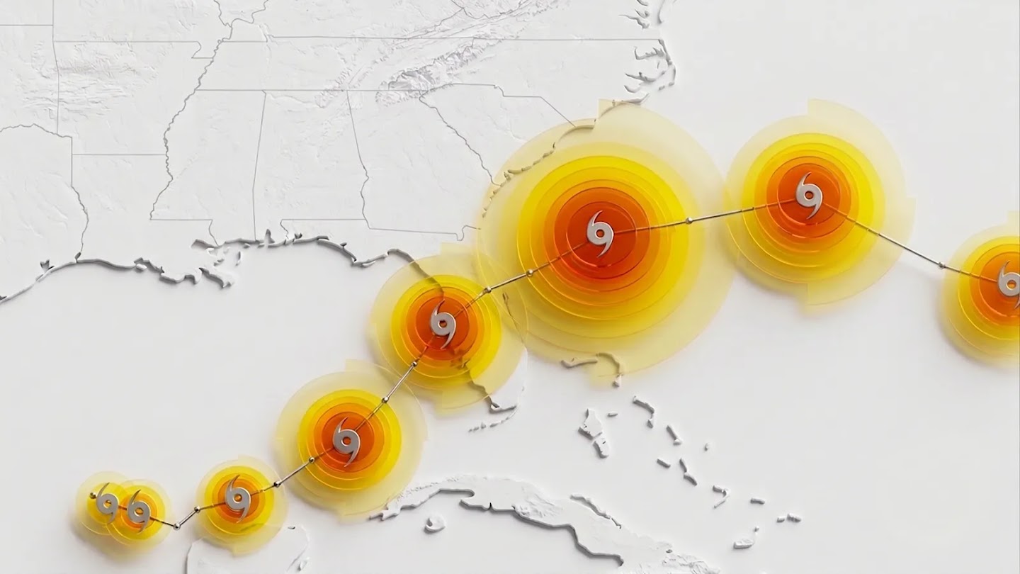
What Happened
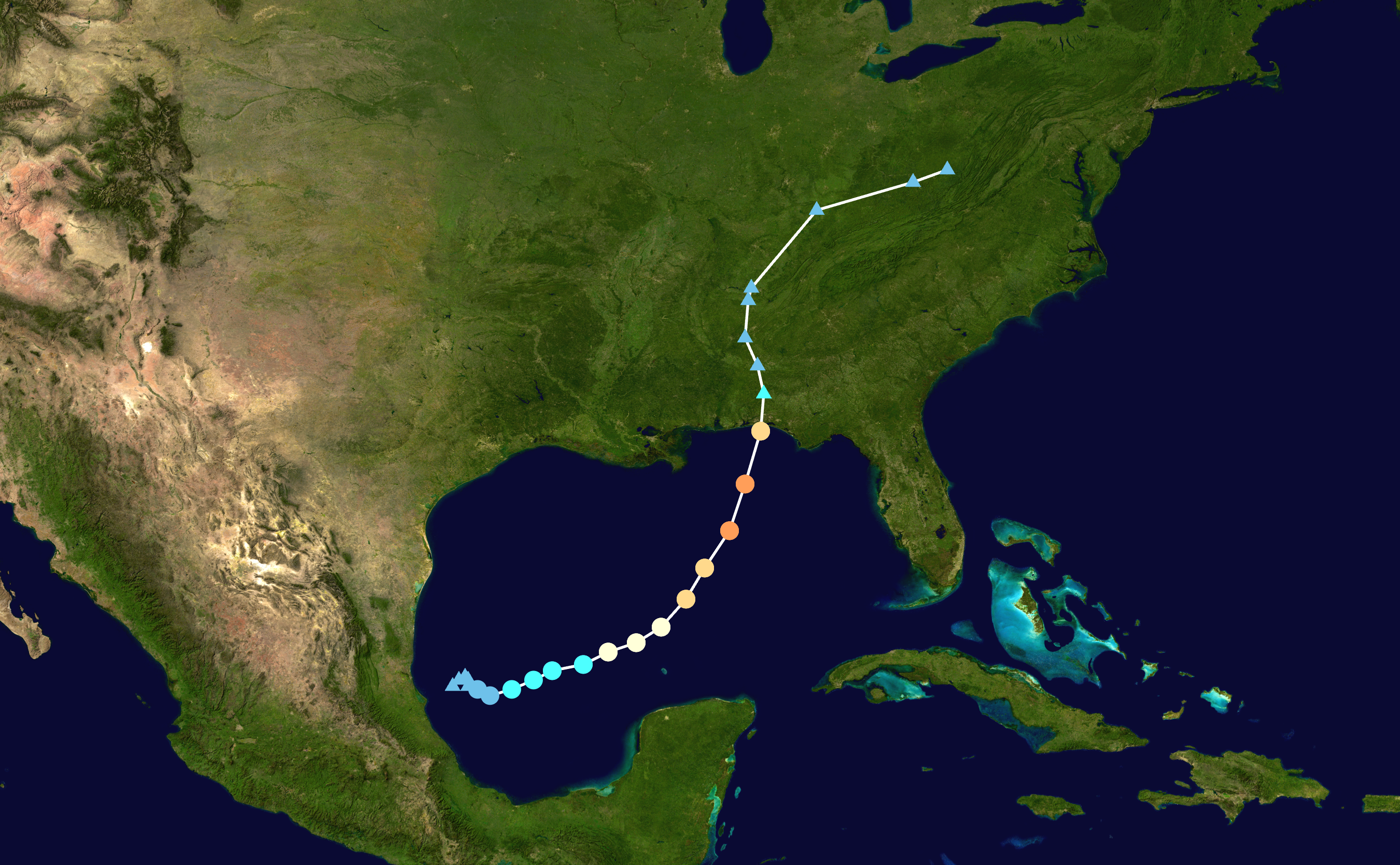
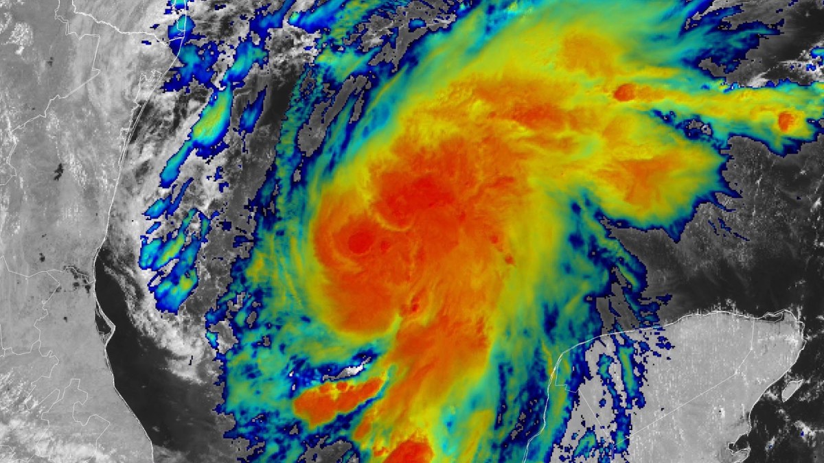
The NHC began monitoring the southwestern Gulf of Mexico on October 3. The system became Tropical Depression Nine at 21:00 UTC on October 6, was named Tropical Storm Isaias the following morning, and was upgraded to a hurricane early on October 8 — the first hurricane of the 2026 Atlantic season, and by a wide margin the latest first hurricane in reliable records. It peaked on October 9 at 120 mph (195 km/h) and 958 mb as a Category 3 major hurricane, then weakened slightly on approach before coming ashore near Destin as a Category 2. It was post-tropical by the morning of October 10.
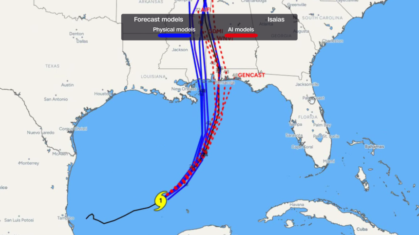
From its first advisory on October 6 — issued before the storm even had a name — the NHC forecast that it would reach Category 2 strength. Many of the physics-based models were, at that point, still spread between a weaker storm on a more westward track. The NHC’s own discussion noted that the AI-based guidance sat on the eastern side of the track envelope and was “generally faster than the physics-based guidance.”
Inside WeatherNext 3
WeatherNext 3, announced on September 3, 2026, is the first global weather model to refresh its forecast every hour. It ingests live geostationary satellite observations directly as a model input rather than assimilating them on a six-hour cycle, and resolves key surface variables down to about 5 km — roughly five times sharper than its predecessor. It runs a 64-member ensemble out to 15 days. Google says independent live evaluations by Brightband rank it the most accurate global weather model to date.
The cyclone-specific side of the family, WeatherNext Cyclones, predicts track, intensity and wind structure up to 15 days ahead, and DeepMind runs a 1,000-member ensemble to produce localised probability maps. In a paper published in Nature in August 2026, the team reported state-of-the-art accuracy on cyclone track and intensity — on average, the equivalent of an extra day of warning, which DeepMind characterises as roughly a decade’s worth of meteorological progress.
Forecasters’ confidence came partly from having trained alongside Google. “We’ve worked with Google to help them train on our best track analysis,” NHC director Michael Brennan told CNN, “and that’s one reason why I think their performance has improved in terms of intensity forecasting relative to some of the earlier AI models that did well for track, but did not do well for intensity.”
How the Forecast Performed
After landfall, WDSU meteorologist Jordan West compared DeepMind’s cyclone ensemble forecast with the European Centre’s physics-based ensemble (ECMWF ENS), both initialised at 18Z on October 6, against what Isaias actually did. The AI forecast was closer on all four metrics:
- Landfall location — DeepMind placed landfall between Petit Bois Island, Mississippi, and Seaside, Florida; the European ensemble pointed at the Louisiana coast; Isaias came ashore at Destin, Florida.
- Peak strength — DeepMind forecast 91.2 mph against the European ensemble’s 61.7 mph. The storm actually peaked at 120 mph.
- Landfall timing — DeepMind predicted just after midnight on October 10, the European ensemble the following evening; the actual landfall was 8:30 p.m. on October 9.
- Intensity at landfall — DeepMind forecast 55 knots against the European ensemble’s 45 knots; the storm came ashore at about 95 knots.
The caveats matter as much as the result. DeepMind was closer on peak intensity but still under-forecast it by nearly 30 mph. The comparison covers one storm over a single forecast cycle, not a season. And the broader record is mixed: an analysis published by Superpower Daily on October 8 found DeepMind beat traditional American and European models on track, especially 12 to 96 hours out, but not the official NHC forecast at five days, and was roughly level with the centre on intensity overall.
There is also precedent. In 2025 the NHC explicitly forecast that Hurricane Melissa would reach Category 5 intensity when it was still an 80 mph Category 1 storm, largely on DeepMind’s guidance, days before Melissa’s rapid intensification and landfall in Jamaica.
What This Means
Isaias is the clearest live test yet of AI weather models in a US landfall, and it shows both the promise and the limits of the approach. AI models are far cheaper and faster to run than physics-based ones, which require supercomputers, and they can be spun up into large ensembles that give forecasters probabilistic guidance rather than a single line on a map. But they learn from historical weather, so they inherit the gaps in that record, and their skill at intensity still trails their skill at track.
For emergency managers, being right earlier is the whole point: a landfall forecast that firms up a day sooner is a day more for evacuations and staging. The NHC, for its part, still treats AI as one input among several. “It’s another tool in the toolbox, so to speak, or another piece of evidence that can help support those more aggressive intensity forecasts,” Brennan said.
Related Coverage
- Google Open-Sources WeatherNext: Cyclone Forecasts Gain a Day — DeepMind’s August 2026 release of the WeatherNext code and weights, alongside the Nature paper behind the cyclone model used here.
This post was drafted with AI assistance and reviewed by RITS staff.
Sources
- CNN — “Why the National Hurricane Center bet big on AI to forecast Isaias” (October 8, 2026)
- WDSU — “Isaias Recap: Did new AI weather models perform better than physics models?” (October 10, 2026)
- Google — “Introducing WeatherNext 3, our most advanced and accurate global weather AI model” (September 3, 2026)
- Google DeepMind — “WeatherNext: AI model achieves breakthrough in forecasting cyclones” (August 6, 2026)
- Nature — WeatherNext cyclone forecasting paper (August 2026)
- Yale Climate Connections — “Strengthening Isaias expected to hit the U.S. Gulf coast Friday as a hurricane” (October 7, 2026)
- Superpower Daily — “National Hurricane Center favors Google AI for a stronger Isaias forecast” (October 8, 2026)
- National Hurricane Center — Hurricane Isaias 2026 advisory archive


 沪公网安备31011502017015号